One of my quests at the moment is to get an accurate idea of what local albedo changes will do to temperature. This is to make it clear for people what they can do to lower temperatures, which can be life saving, not only human lifes but of all lives. I’m working with a climate expert to find answers. The scale we work on now is still crude : 9km x 9km.

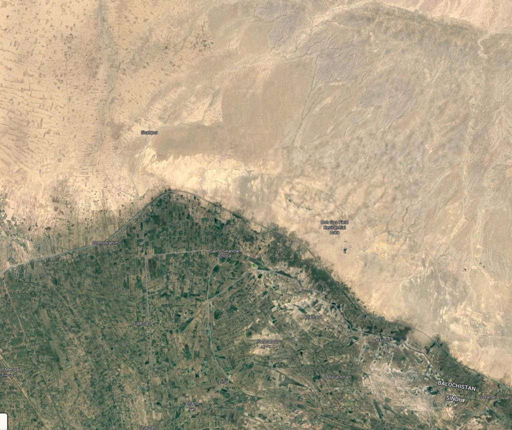
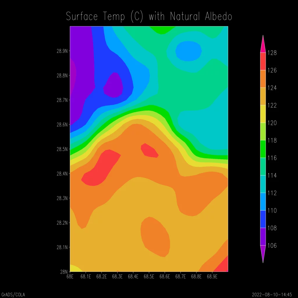
The above shows a region in Pakistan, with farmland next to dry uncultivated land. Possibly because of an underground aquifer or river, but also because of temperature differences. The albedo of green land and sand is similar about 30%, just in a different spectral regions. The model shows the temperature distribution under ‘normal’ conditions.

This image shows the sandy area is actually cooler than the agricultural area. This can be because the green shrub and black soil absorp more heat. If you increase the albedo of the entire area you get this result..

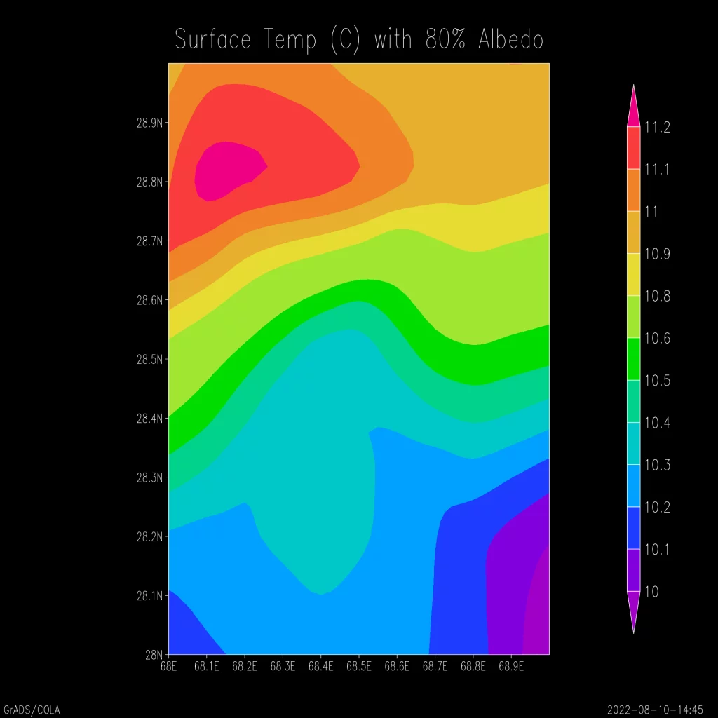
This is the area with higher albedo 80%. The agricultual land is much cooler, it seems almost 100 degrees Fahrenheit! But we effectively turned the whole area in a polar ice region. I am working on a more detailed model. What would happen if you add alternating rows of white soil (calcium) between vegetation? If you know good models let me know.
A good question is also : If you increase albedo and the temperatures drop, does that mean it will start to rain? To be continued..